Shrone Lake
Shrone Lake
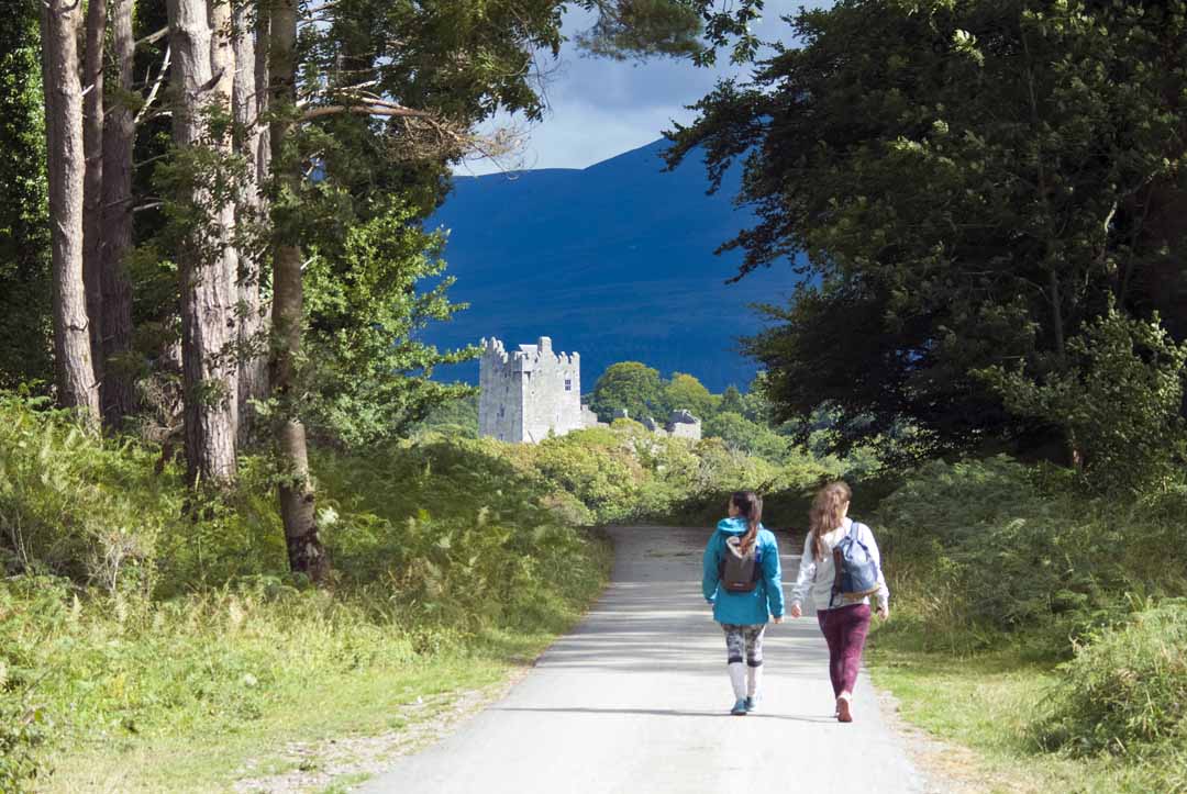
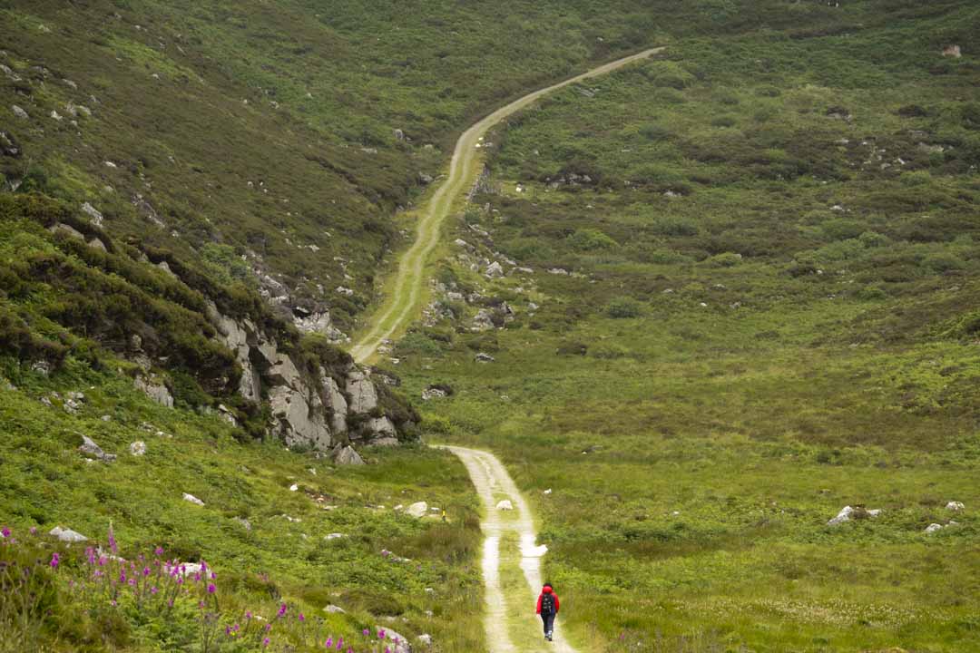
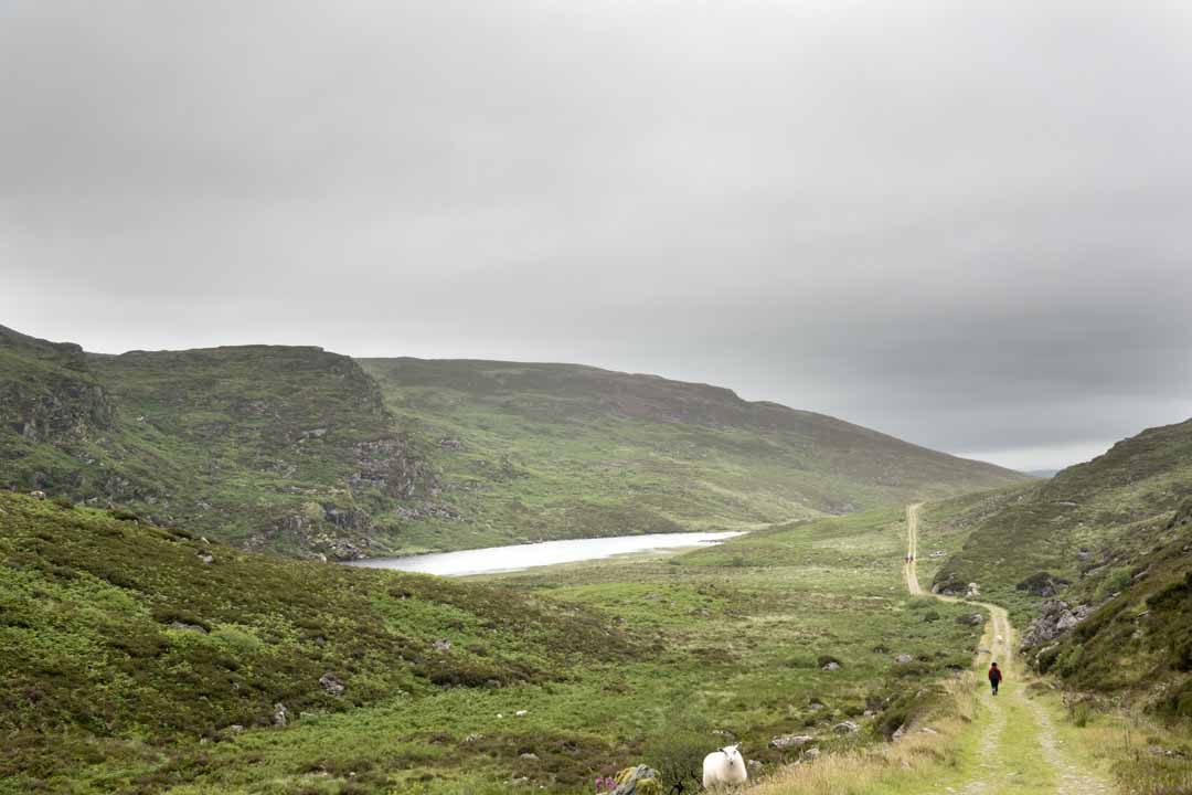
Ideal short but manageable hill walk, to Shore Lake which is part of the Duhallow Trail and gateway to the Paps. We had good conditions and met many people on their way to the Paps and they look well prepared for there journey, This walk is just of the Cork to Killarney road, and can be difficult to find and has very limited car parking. We had a great day with terrific scenery with a good quality trail, this only whets our appetite to return and visit the Paps.
Ideal short but manageable hill walk, to Shore Lake which is part of the Duhallow Trail and gateway to the Paps. We had good conditions and met many people on their way to the Paps and they look well prepared for there journey, This walk is just of the Cork to Killarney road, and can be difficult to find and has very limited car parking. We had a great day with terrific scenery with a good quality trail, this only whets our appetite to return and visit the Paps.
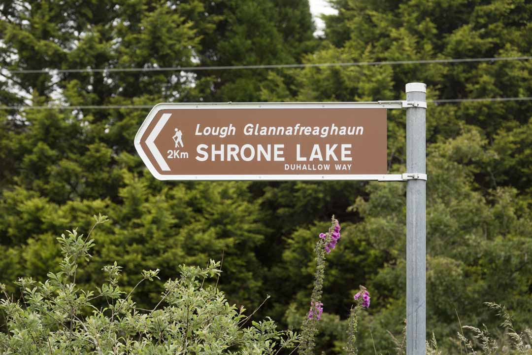
The trail to Shrone Lake is good, but this is a walk for hillwalkers.
The trail to Shrone Lake is good, but this is a walk for hillwalkers.
From Above
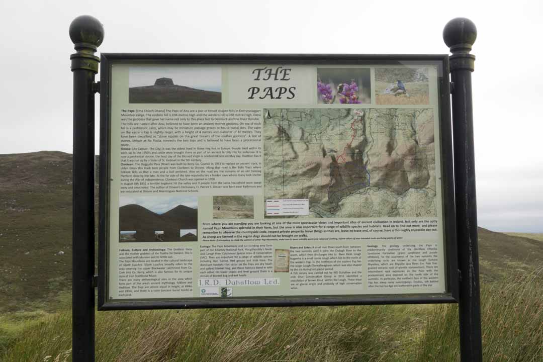
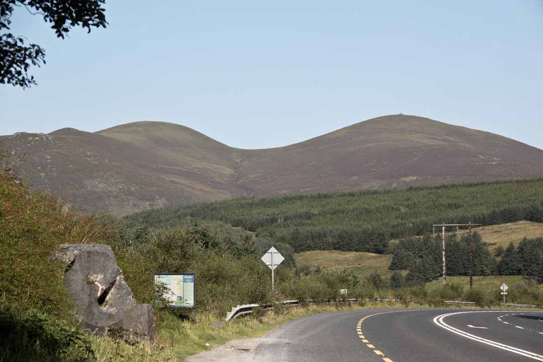
The Paps: [Dha Chioch Dhana] The Paps of Any is a pair of breast-shaped hills in Derrynasaggart Mountain range. The eastern hill is 694 metres high and the western hill is 690 meters high. Danu was the goddess that gave her name not only to this place but to Denmark and the river Danube. The hills are named after Anu; believed to have been an ancient mother goddess. On top of each hill is a prehistoric cairn, which may be miniature passage graves or house burial cists. The cairn on the eastern Pap is slightly larger, with a height of 4 metres and a diameter of 16 meters. They have been described as “stone nipples on the great breasts of the mother goddess”. A line of stones, known as Na Fiacla, connects the two tops and is believed to have been a processional route.
The Paps: [Dha Chioch Dhana] The Paps of Any is a pair of breast-shaped hills in Derrynasaggart Mountain range. The eastern hill is 694 metres high and the western hill is 690 meters high. Danu was the goddess that gave her name not only to this place but to Denmark and the river Danube. The hills are named after Anu; believed to have been an ancient mother goddess. On top of each hill is a prehistoric cairn, which may be miniature passage graves or house burial cists. The cairn on the eastern Pap is slightly larger, with a height of 4 metres and a diameter of 16 meters. They have been described as “stone nipples on the great breasts of the mother goddess”. A line of stones, known as Na Fiacla, connects the two tops and is believed to have been a processional route.
Shrone: [an Cathair- The City] It was the oldest lived in Stone ring fort in Europe. People lived within its walls up to the 1950s and cattle were brought there as part of an ancient fertility rite for millennia. It is now a penitential station, the feast day of the Blessed Virgin is celebrated here on Mayday. Tradition has it that it was set up by a Sister of St. Gobnait in the 5th Century.
Shrone: [an Cathair- The City] It was the oldest lived in Stone ring fort in Europe. People lived within its walls up to the 1950s and cattle were brought there as part of an ancient fertility rite for millennia. It is now a penitential station, the feast day of the Blessed Virgin is celebrated here on Mayday. Tradition has it that it was set up by a Sister of St. Gobnait in the 5th Century.
Clonkeen
Clonkeen
Clonkeen: The Slyggudal Pass (Road) was built by Kerry Co.Council in 1931 to replace an ancient track. In olden times this track took people from Clonkeen to Shrone. Along that road is the Bulls Track where folklore tells us that a man and bull perished. Also on the road are the remains of an old Dancing Platform close by the lake. At the far side of the lake reputedly lies a hidden cave where many took shelter during the War of Independence. Clonkeen Church was opened in 1958.
Clonkeen: The Slyggudal Pass (Road) was built by Kerry Co.Council in 1931 to replace an ancient track. In olden times this track took people from Clonkeen to Shrone. Along that road is the Bulls Track where folklore tells us that a man and bull perished. Also on the road are the remains of an old Dancing Platform close by the lake. At the far side of the lake reputedly lies a hidden cave where many took shelter during the War of Independence. Clonkeen Church was opened in 1958.
In August 6th 1831 a terrible bog burst hit the valley and 9 people from the same household were swept away and smothered. The author of Dineen’s Dictionary, Fr. Patric s.Dineen was born near Rathmore and was educated at Shrone and Meentogues National Schools.
In August 6th 1831 a terrible bog burst hit the valley and 9 people from the same household were swept away and smothered. The author of Dineen’s Dictionary, Fr. Patric s.Dineen was born near Rathmore and was educated at Shrone and Meentogues National Schools.
Ecology: The Paps Mountains and surrounding area from part of the Killarney Park, Macgillycuddy’s Reeks and Caragh River Catchment Special Area of Conservation (SAC). They are important for a range of wildlife species including Hen harrier, Red grouse and Irish Hare. The dominant habitats that occur on the Paps are dry heath and upland blanket bog, and these habitats blend in with each other. On lower slopes and level ground, there is a mosaic of blanket bog and wet heath.
Ecology: The Paps Mountains and surrounding area from part of the Killarney Park, Macgillycuddy’s Reeks and Caragh River Catchment Special Area of Conservation (SAC). They are important for a range of wildlife species including Hen harrier, Red grouse and Irish Hare. The dominant habitats that occur on the Paps are dry heath and upland blanket bog, and these habitats blend in with each other. On lower slopes and level ground, there is a mosaic of blanket bog and wet heath.
The Goddess Danu
The Goddess Danu
Folklore, Culture and Archaeology: The Goddess Danu was the mother goddess of the Tuatha De Danann. She is associated with Munster and its fertile soil.
Folklore, Culture and Archaeology: The Goddess Danu was the mother goddess of the Tuatha De Danann. She is associated with Munster and its fertile soil.
The Paps Mountains are located in the cultural landscape of Sliabh Luachra. Sliabh Luachra broadly refers to the area covering the upper Blackwater catchment from Co.Cork into Co. Kerry, which is also famous for its unique style of Irish Traditional Music.
The Paps Mountains are located in the cultural landscape of Sliabh Luachra. Sliabh Luachra broadly refers to the area covering the upper Blackwater catchment from Co.Cork into Co. Kerry, which is also famous for its unique style of Irish Traditional Music.
There are many archaeological sites in the area’s which form part of the area’s ancient mythology, folklore and tradition. The Paps are almost equal in height, at 694m and 690m, and there is a cairn (ancient burial tomb) at each peak.
There are many archaeological sites in the area’s which form part of the area’s ancient mythology, folklore and tradition. The Paps are almost equal in height, at 694m and 690m, and there is a cairn (ancient burial tomb) at each peak.
Rivers and Lakes: A small river flows south from between the two summits until it joins the Clydagh River to the south, which them discharges into the River Flesk. Lough Nageeha is a small corrie Lough which lies to the north of the western Pap. To the northeast of the eastern Pap lies the larger Lough Glannafreaghaun which was also shaped by the ice during the last glacial period.
Rivers and Lakes: A small river flows south from between the two summits until it joins the Clydagh River to the south, which them discharges into the River Flesk. Lough Nageeha is a small corrie Lough which lies to the north of the western Pap. To the northeast of the eastern Pap lies the larger Lough Glannafreaghaun which was also shaped by the ice during the last glacial period.
A fish survey was carried out by IRD Duhallow and the Irish Char Conservation Group in 2011 identified a population of brown trout within the Lough. These trout are of glacial origin and probably of high conservation value.
A fish survey was carried out by IRD Duhallow and the Irish Char Conservation Group in 2011 identified a population of brown trout within the Lough. These trout are of glacial origin and probably of high conservation value.
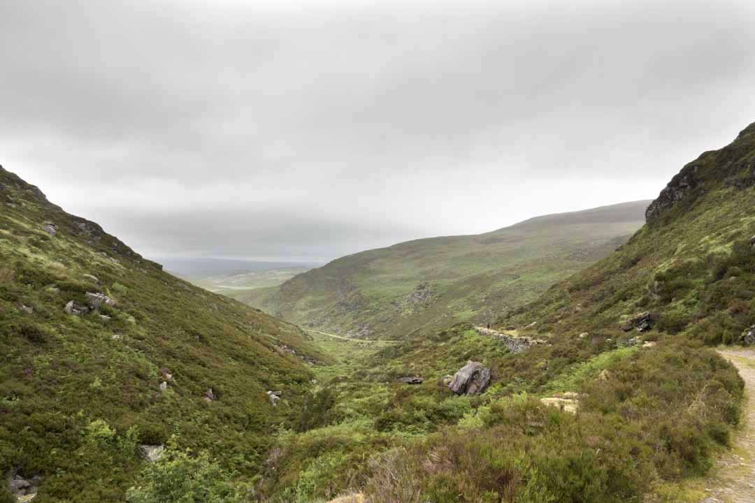
Geology: The geology underlying the Paps is predominantly sandstone of the Glenflesk Chloritic Sandstone Formation (green sandstone and purple siltstone). To the southwest of the two summits, the underlying rocks are known as the Lough Guitane Rhyolites, which are Rhyolite lava flows (i.e. Pale fine-grained volcanic rock of granitic composition). There are intermittent rock exposures on the Paps with the predominant area exposed on the north side of the summits. In particular, the northern face of the western Pap has steep rocky outcroppings. Erratics left behind after the last Ice Age are scattered in parts of the site.
Geology: The geology underlying the Paps is predominantly sandstone of the Glenflesk Chloritic Sandstone Formation (green sandstone and purple siltstone). To the southwest of the two summits, the underlying rocks are known as the Lough Guitane Rhyolites, which are Rhyolite lava flows (i.e. Pale fine-grained volcanic rock of granitic composition). There are intermittent rock exposures on the Paps with the predominant area exposed on the north side of the summits. In particular, the northern face of the western Pap has steep rocky outcroppings. Erratics left behind after the last Ice Age are scattered in parts of the site.

Kerry

