Athlone Greenway
Athlone Greenway
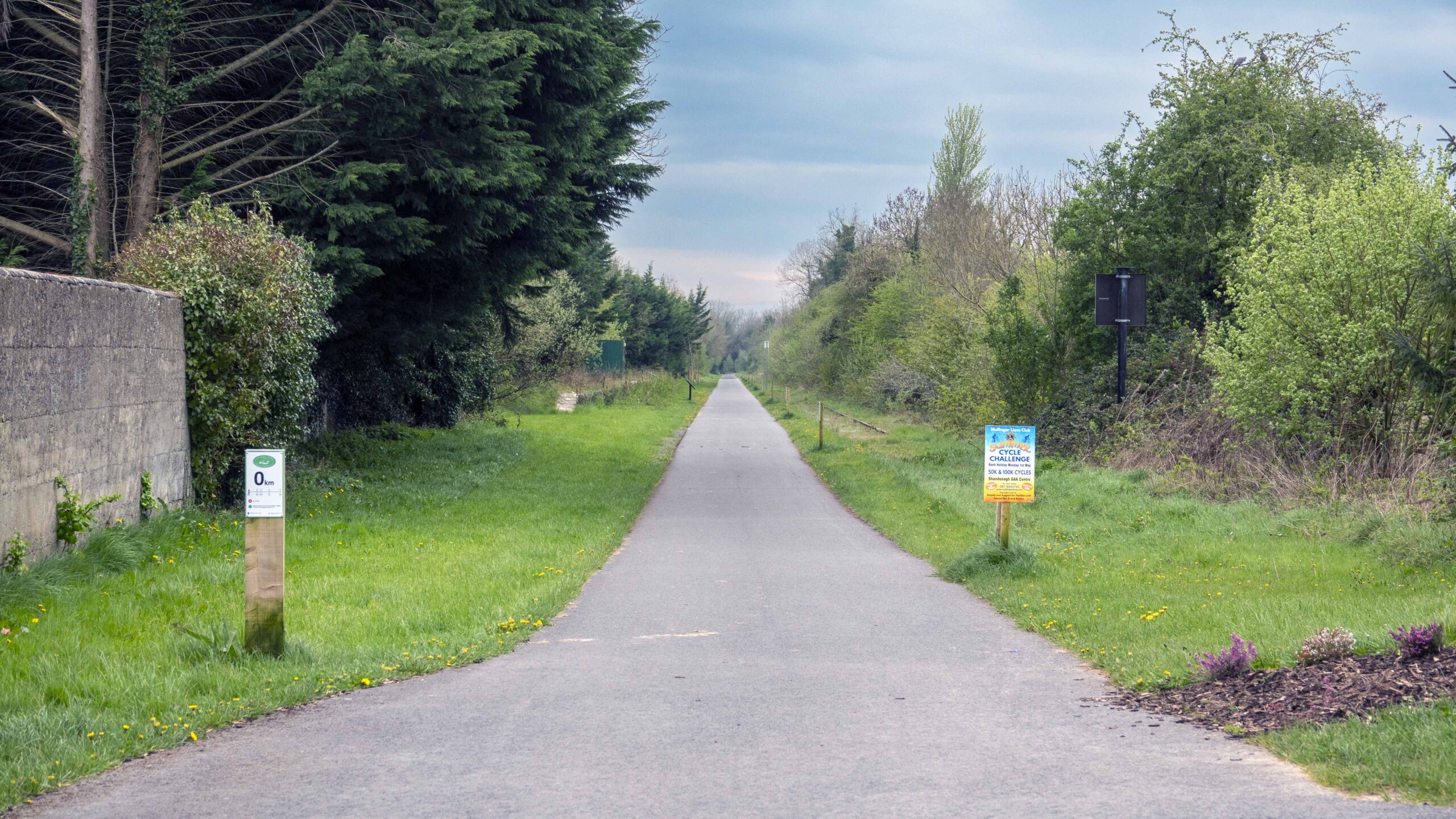
The Athlone to Mullingar Greenway is 42km
The Athlone to Mullingar Greenway is 42km
1-6 Athlone to Moat
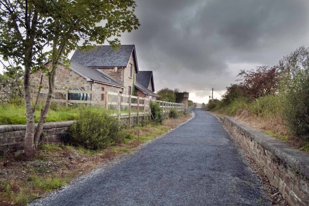
Distance 14.5 km Services at 2, 5 and 6. Purpose built off-road shared pedestrian and cycleway trail, along disused railway track. Generally flat, smooth sealed surface with the exception of a surface dressed 2km stretch between 2 and 3 . This surface dressed section runs over the Crossword bog area, which lies on approximately 6m of peat. There is also direct access to Dun na Is Amenity and Heritage Park at 5, which consists of a cafe and an exciting range of recreational, educational, environmental, cultural and historic activitie
1-6 Athlone to Moat
Distance 14.5 km Services at 2, 5 and 6. Purpose built off-road shared pedestrian and cycleway trail, along disused railway track. Generally flat, smooth sealed surface with the exception of a surface dressed 2km stretch between 2 and 3 . This surface dressed section runs over the Crossword bog area, which lies on approximately 6m of peat. There is also direct access to Dun na Is Amenity and Heritage Park at 5, which consists of a cafe and an exciting range of recreational, educational, environmental, cultural and historic activitie
6-10 Moat to Castletown
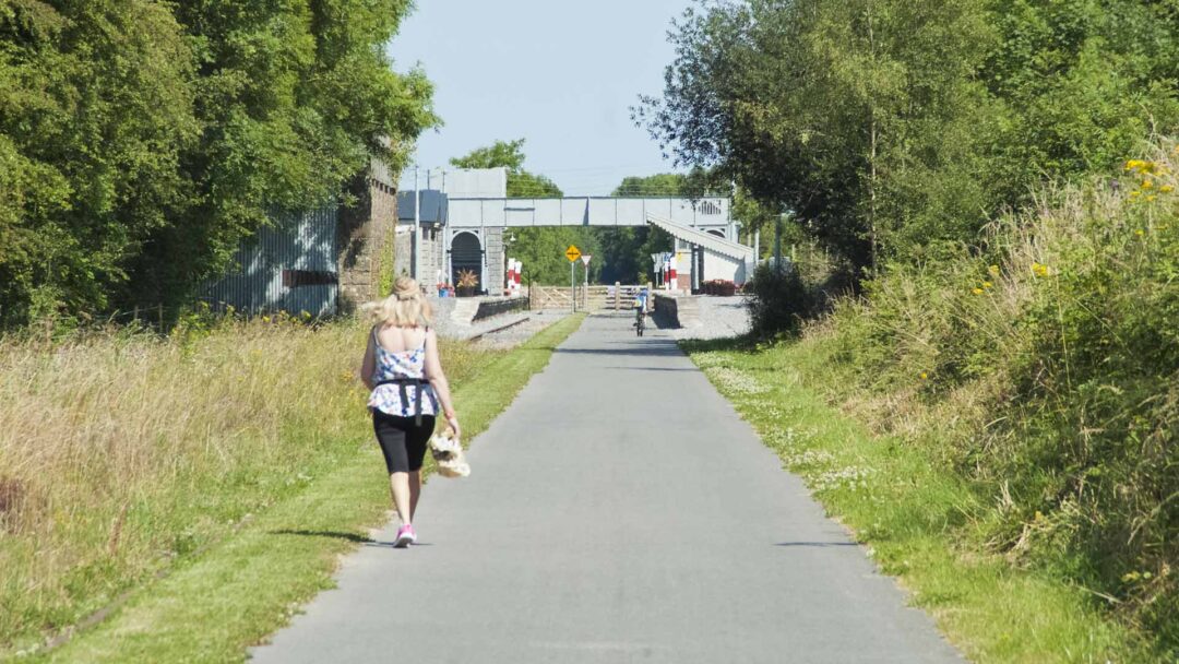
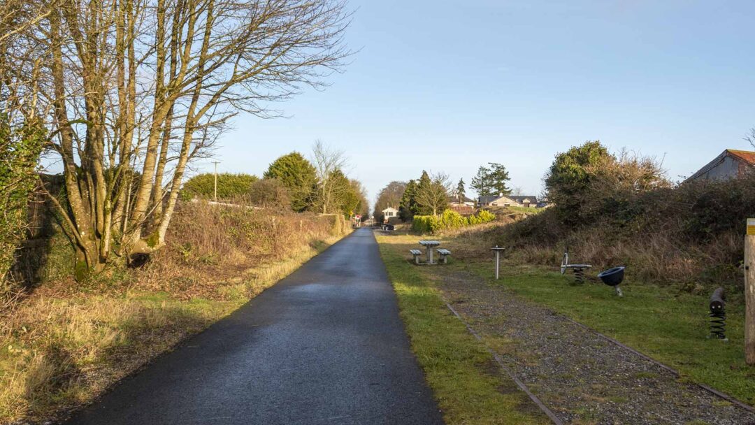
Distance 16.3 km. Services available at 6 and 10. Purpose built off-road shared pedestrian and cycleway trail, along disused railway track. Smooth sealed surface generally flat with some gentle slopes. This section of the Midlands Great Western Railway passes through the old station at 6, 8 and 9.
6-10 Moat to Castletown
Distance 16.3 km. Services available at 6 and 10. Purpose built off-road shared pedestrian and cycleway trail, along disused railway track. Smooth sealed surface generally flat with some gentle slopes. This section of the Midlands Great Western Railway passes through the old station at 6, 8 and 9.
10-15 Castletown to Mullingar
10-15 Castletown to Mullingar
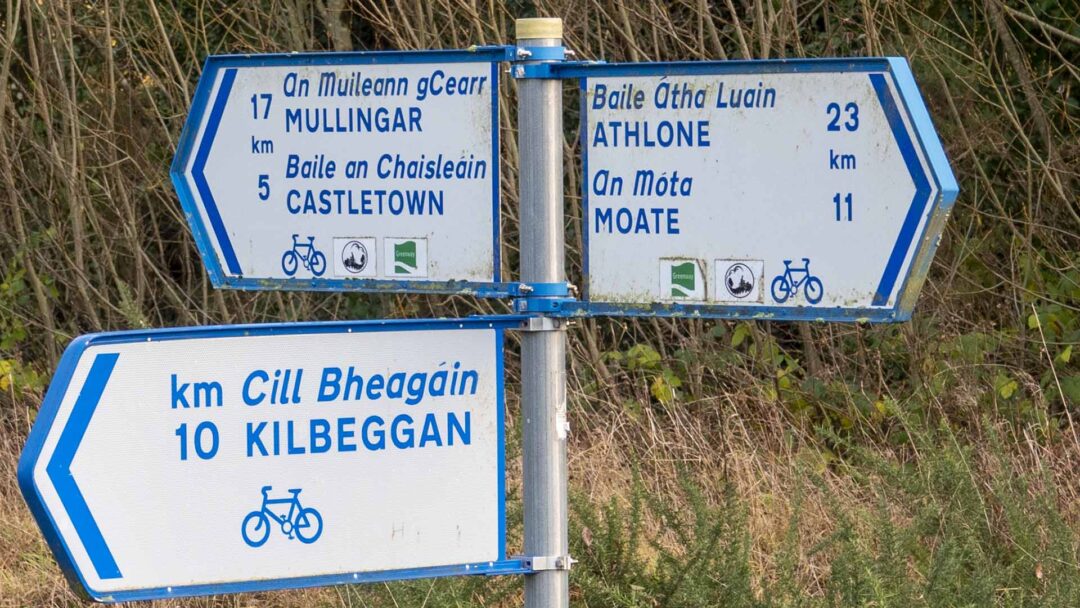
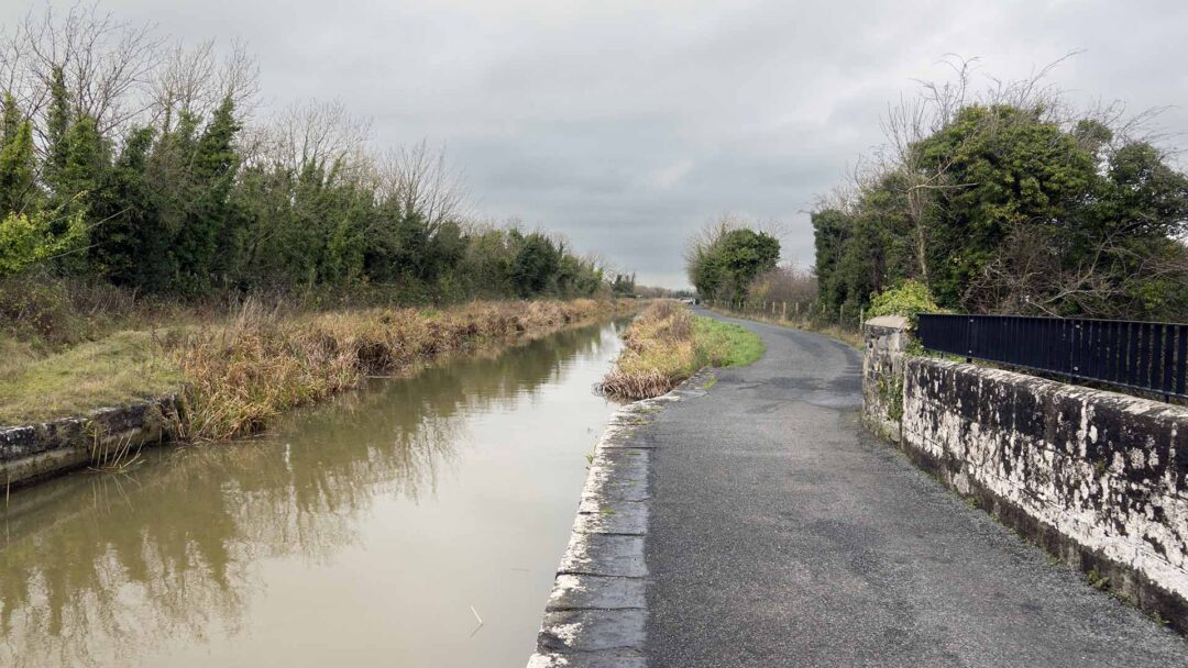
Purpose built off-road shared pedestrian and cycleway trail, along disused railway track. Smooth sealed surface generally flat with some gentle slopes. There is access to the Royal Canal Greenway at 13 and 14 which link to Abbeyshrule and Ballymahon. There is also access to Maynooth via the Royal Canal Greenway at 15.
Purpose built off-road shared pedestrian and cycleway trail, along disused railway track. Smooth sealed surface generally flat with some gentle slopes. There is access to the Royal Canal Greenway at 13 and 14 which link to Abbeyshrule and Ballymahon. There is also access to Maynooth via the Royal Canal Greenway at 15.
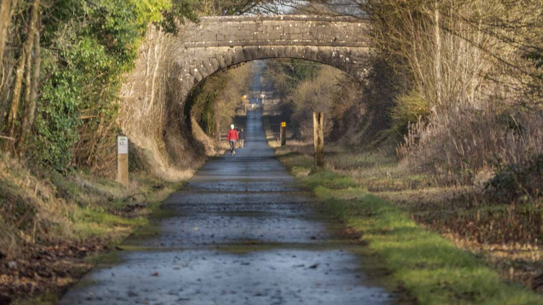
The Athlone Greenway is also known as the Old Rail Trail
The Athlone Greenway is also known as the Old Rail Trail
The Old Rail Trail
The Old Rail Trail
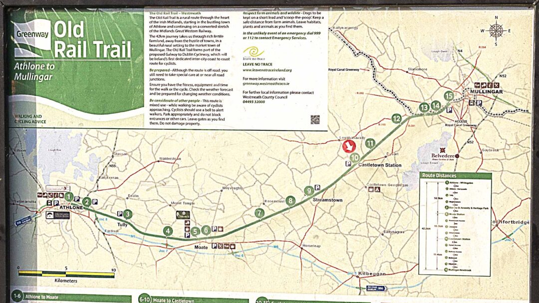
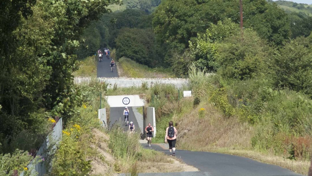
The Old Rail Trail Greenway is a 42-km cycle path that runs through the rural Irish midlands. The starting point of this trail is Athlone. Mullingar is the endpoint of this beautiful greenway with unparalleled scenic beauty. As you go through this route, you can find areas of unique biodiversity and heritage.
The Old Rail Trail Greenway is a 42-km cycle path that runs through the rural Irish midlands. The starting point of this trail is Athlone. Mullingar is the endpoint of this beautiful greenway with unparalleled scenic beauty. As you go through this route, you can find areas of unique biodiversity and heritage.
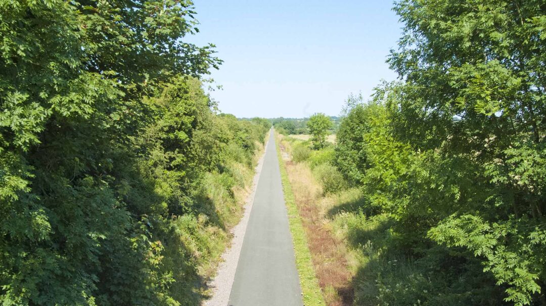
This greenway is divided into three sections, Athlone to Moate (14.5km), Moate to Castletown (16.3km), and Castletown to Mullingar (11.4 km). The first two sections contain only flat surfaces to make them ideal tracks for people of all ages and fitness levels. Even the third section is mostly flat with a few gentle slopes.
This greenway is divided into three sections, Athlone to Moate (14.5km), Moate to Castletown (16.3km), and Castletown to Mullingar (11.4 km). The first two sections contain only flat surfaces to make them ideal tracks for people of all ages and fitness levels. Even the third section is mostly flat with a few gentle slopes.
The 42km journey takes us through rich fertile farmland, away from the hustle of town, in a beautiful rural setting to the market town of Mullingar. The Old Rail Line forms part of the proposed Galway to Dublin cycleway, which will be Ireland’s first dedicated inter-city coast to coast route for cyclists.
The 42km journey takes us through rich fertile farmland, away from the hustle of town, in a beautiful rural setting to the market town of Mullingar. The Old Rail Line forms part of the proposed Galway to Dublin cycleway, which will be Ireland’s first dedicated inter-city coast to coast route for cyclists.
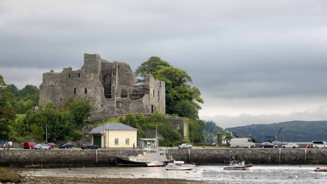
As you cycle from Athlone to Mullingar, you can find 16 access points. This trail offers a serene ambiance to make you feel relaxed and rejuvenated. The most prominent attractions along the route include Athlone Castle, Dun Na Sí Amenity & Heritage Park, Streamstown Bridges, Castletown Station, Hill of Uisneach, and Royal Canal.
As you cycle from Athlone to Mullingar, you can find 16 access points. This trail offers a serene ambiance to make you feel relaxed and rejuvenated. The most prominent attractions along the route include Athlone Castle, Dun Na Sí Amenity & Heritage Park, Streamstown Bridges, Castletown Station, Hill of Uisneach, and Royal Canal.
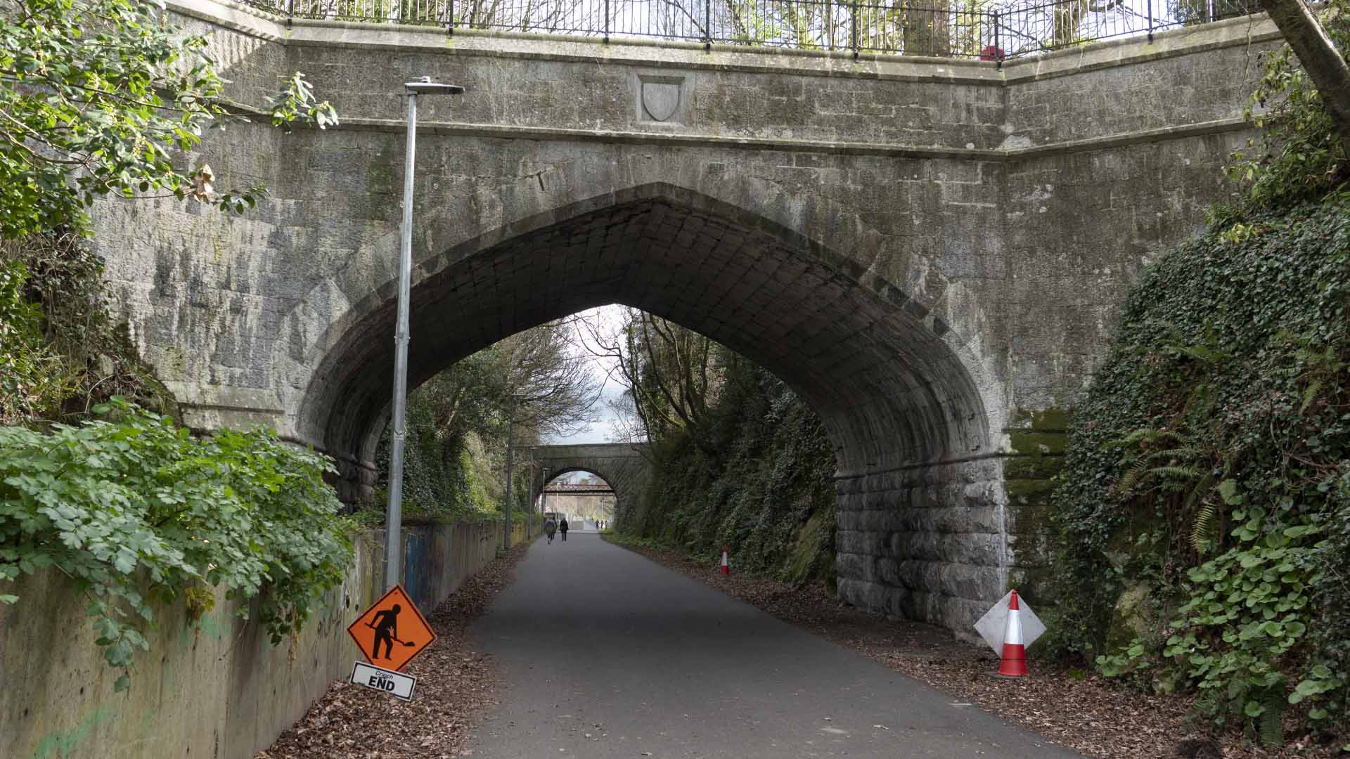
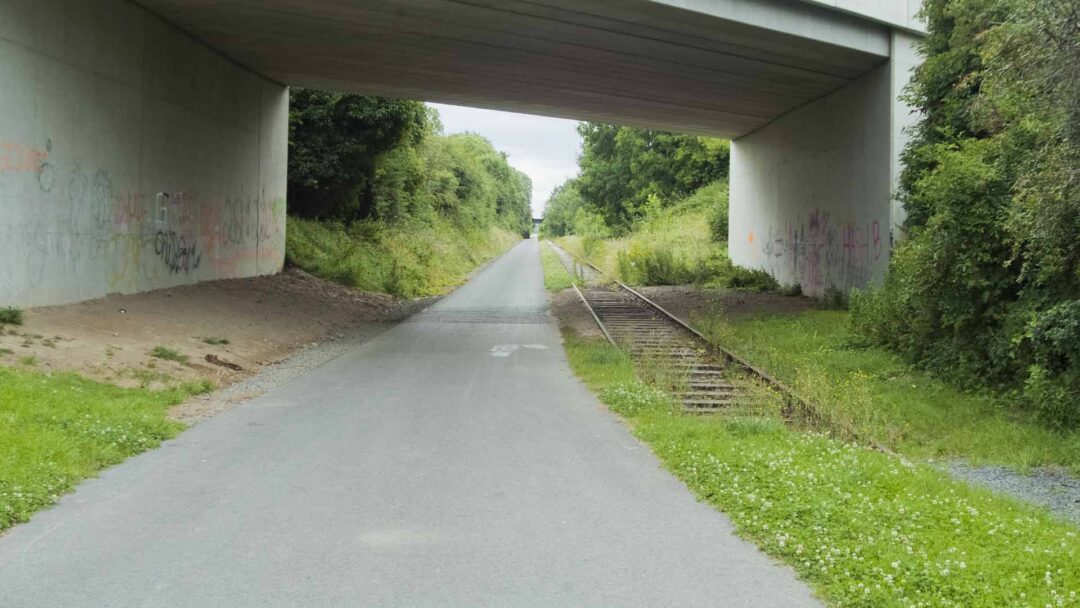
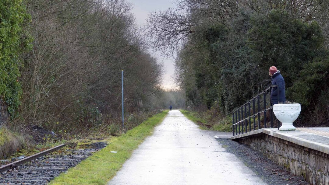
The Old Rail Trail is a rural route through the heart of the Irish Midlands, starting at the bustling town of Athlone and continuing on a converted stretch of the Midlands Great Western Railway.
The Old Rail Trail is a rural route through the heart of the Irish Midlands, starting at the bustling town of Athlone and continuing on a converted stretch of the Midlands Great Western Railway.
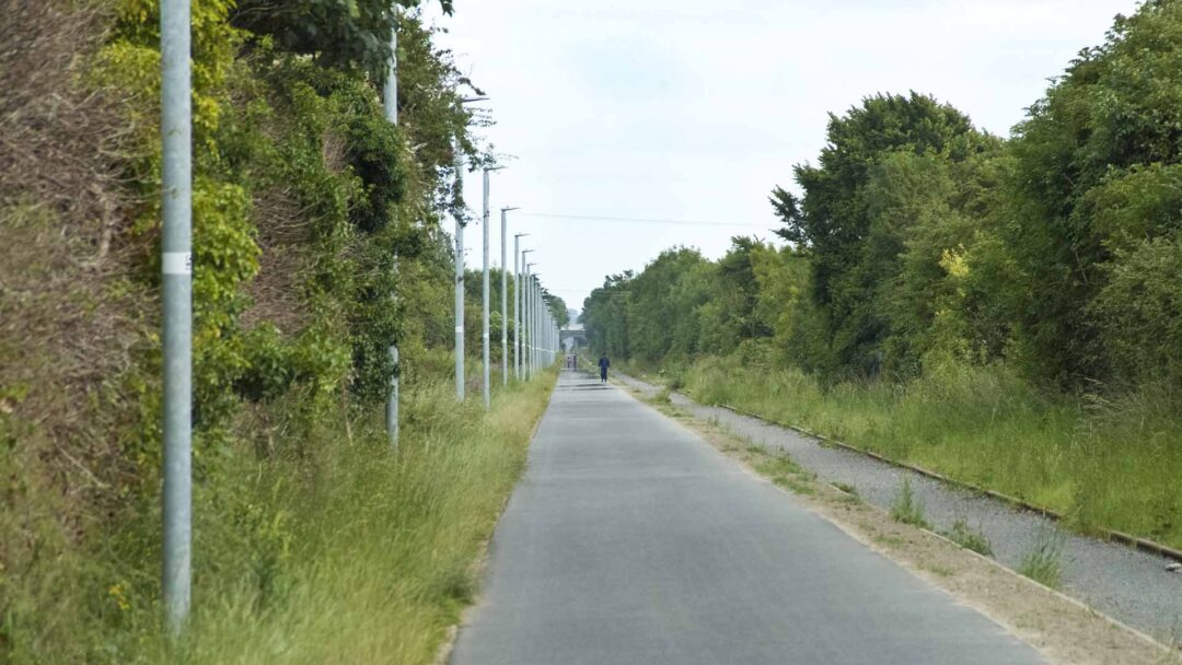
Ensure you have the fitness, equipment and time for the walk or the cycle. Check the weather forecast and be prepared for changing weather conditions.
Ensure you have the fitness, equipment and time for the walk or the cycle. Check the weather forecast and be prepared for changing weather conditions.
An Taoiseach, Enda Kenny opened the Old Rail Trail on the 18th October 2015. At present in runs from Athlone to Mullingar, but this could be the middle of the proposed Dublin and Galway Greenway. But for now, this fantastic car-free trail takes us through farmland giving us plenty of time to walk or cycle. The track still exists in places, the line was closed in 1987.
An Taoiseach, Enda Kenny opened the Old Rail Trail on the 18th October 2015. At present in runs from Athlone to Mullingar, but this could be the middle of the proposed Dublin and Galway Greenway. But for now, this fantastic car-free trail takes us through farmland giving us plenty of time to walk or cycle. The track still exists in places, the line was closed in 1987.
You can complete this trail within 6 hours using a cycle. However, many people prefer to stop and enjoy the surrounding attractions. If you are one of them, the best choice available is to travel in sections. You can spend the night in Westmeath and take a rest before proceeding to Castletown. If you follow a leisurely approach, you can make your trip more rewarding and entertaining.
You can complete this trail within 6 hours using a cycle. However, many people prefer to stop and enjoy the surrounding attractions. If you are one of them, the best choice available is to travel in sections. You can spend the night in Westmeath and take a rest before proceeding to Castletown. If you follow a leisurely approach, you can make your trip more rewarding and entertaining.
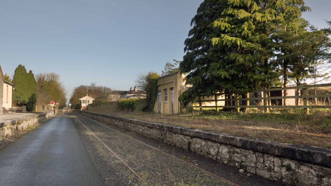
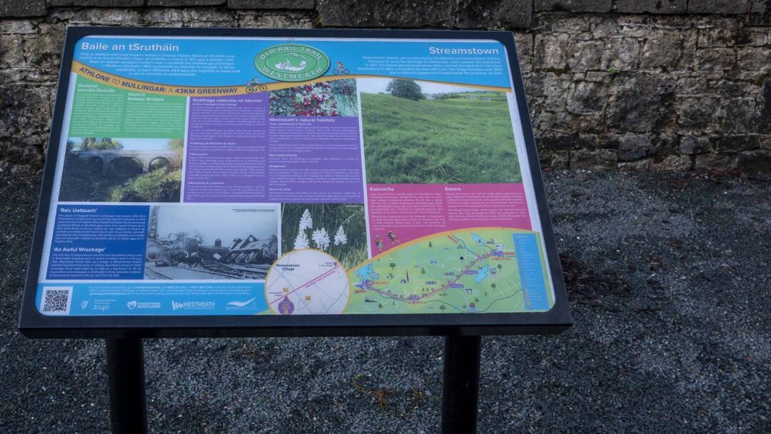
Streamstown
Streamstown
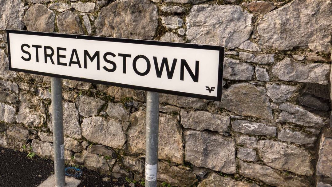
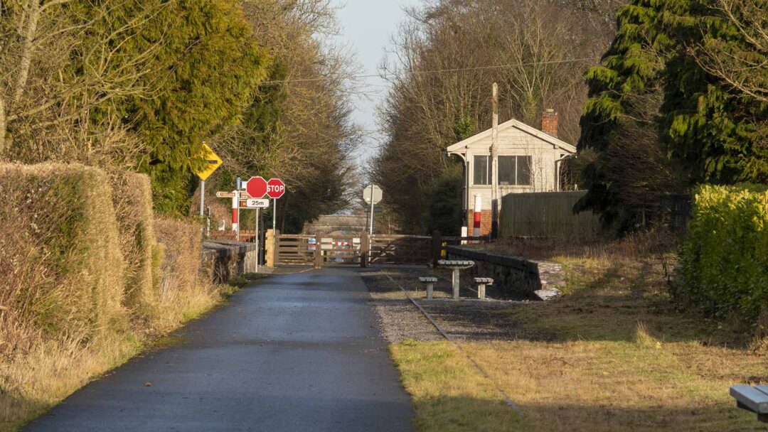
Streamstown, Co.Westmeath, was a wayside station on the former Midland Great Western Railway’s main line between Mullingar and Athlone, which had opened in August 1851. The station’s importance was increased in 1876 when it became a junction for the short branch line to Clara. However, passenger services over the branch were withdrawn in 1947, but it remained open for infrequent goods traffic until June 1963, by which time Streamstown Station itself was also closed completely. The line through Streamstown lost its regular passenger service in 1987, but the the Mullingar to Athlone route remained in use however for frequent freight trains up to the late 1980s, and latterly specials and PWD workings until early 2000s.
Streamstown, Co.Westmeath, was a wayside station on the former Midland Great Western Railway’s main line between Mullingar and Athlone, which had opened in August 1851. The station’s importance was increased in 1876 when it became a junction for the short branch line to Clara. However, passenger services over the branch were withdrawn in 1947, but it remained open for infrequent goods traffic until June 1963, by which time Streamstown Station itself was also closed completely. The line through Streamstown lost its regular passenger service in 1987, but the the Mullingar to Athlone route remained in use however for frequent freight trains up to the late 1980s, and latterly specials and PWD workings until early 2000s.
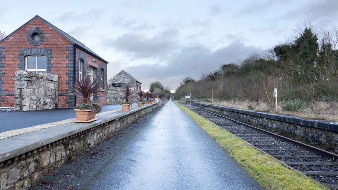
The station at Streamstown formerly consisted of Up & Down platforms, the latter been an island which also served the branch trains to Clara. The main station buildings were located on this island platform, while on the Up side was a waiting shelter, goods shed and loading bank. Today, the derelict platforms remain in situ, as does the shelter and former goods shed, but only the base of the water tower survives on the Down side, all other buildings having been demolished since closure in 1963.
The station at Streamstown formerly consisted of Up & Down platforms, the latter been an island which also served the branch trains to Clara. The main station buildings were located on this island platform, while on the Up side was a waiting shelter, goods shed and loading bank. Today, the derelict platforms remain in situ, as does the shelter and former goods shed, but only the base of the water tower survives on the Down side, all other buildings having been demolished since closure in 1963.
Castletown
Castletown
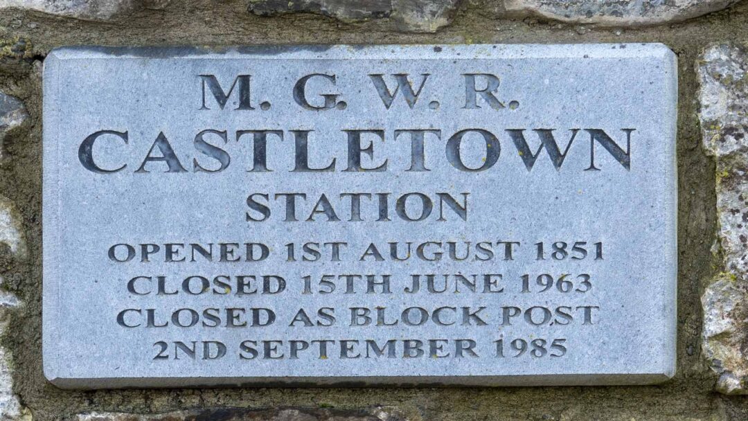
Castletown, Co.Westmeath, was a wayside station on the former Midland Great Western Railway’s main line between Mullingar and Athlone, which opened in August 1851. Up to 1973, this line was used by all Galway and Mayo line trains, but these were re-routed via Portarlington from Great Southern & Western Railway’s Heuston Station in Dublin. Thus the Mullingar to Athlone line became the poor relation to the main line to Galway and the west after this, with the last scheduled passenger service having traversed the route in 1987. The line remained in use however for frequent freight trains up to the late 1980s, and latterly specials and PWD workings until early 2000s.
Castletown, Co.Westmeath, was a wayside station on the former Midland Great Western Railway’s main line between Mullingar and Athlone, which opened in August 1851. Up to 1973, this line was used by all Galway and Mayo line trains, but these were re-routed via Portarlington from Great Southern & Western Railway’s Heuston Station in Dublin. Thus the Mullingar to Athlone line became the poor relation to the main line to Galway and the west after this, with the last scheduled passenger service having traversed the route in 1987. The line remained in use however for frequent freight trains up to the late 1980s, and latterly specials and PWD workings until early 2000s.
From Above
From Above
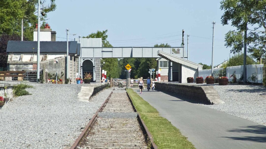
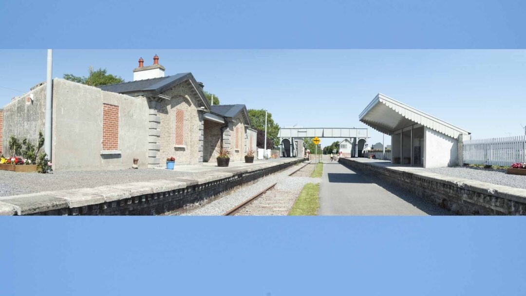
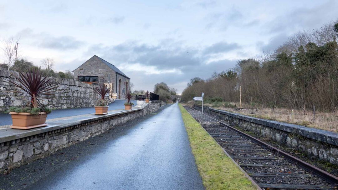
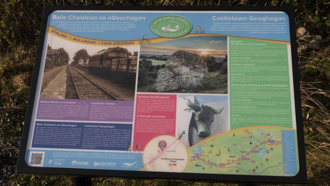
Castletown Station
Castletown Station was probably designed by the Midland and Great Western Railway’s chief engineer, George W Hemans (1814-1885) who later became New Zealand’s engineer-in-chief. After operating for over a century, the station was closed in 1963. Many other railway stations and lines ceased operating at this time as they were considered no longer economically viable. Other historic station structures can be found at Mullingar, Streamstown and Moate.
Castletown Geoghegan
As a medieval settlement, Castletown Geoghegan still contains one of the more imposing Motte and Bailey structures in Ireland and a graveyard dating to around 1400. This graveyard is historically important as a resting place of key historical figures, including members of the Geoghegan family. The MacEochagain (Geoghegan) family are prominent in a set of historical records called the Annals of Clonmacnoise which were translated into Elizabethan English in the 16th century by Franciscan monk, Conall Geoghegan. The family are also known for the Mac Geoghegan’s History of Ireland, a book that would heavily feature in the reading of Eamon De Valera, former President of Ireland.
A final epic encounter
The area was also mentioned in the epic ancient tale of the ‘Táin Bó Cuailgne’ or ‘Cattle Raid of Cooley! During the last battle which took place between Mullingar and Athlone as Queen Medb’s Connacht army headed west, Ulster warrior Láegaire Búadach urged his comrades to ‘drive Connacht’s force from Uisneach hill. It is thought that the town of Athlone gets its name (‘Ath Luain’ / Ford of the Loin) from the Táin Bó Cúailgne.
At the heart of Ireland: the Hill of Uisneach
Just 5km from the Old Rail Trail at Castletown Station, the Hill of Uisneach commands a view of 20 counties on a clear day.
It was considered to be the gateway to Midhe, the mythical fifth province of Ireland. This portal was believed to be blocked by the ‘Ail na Mireann’ (Stone of Divisions), a 30 tonne limestone boulder on the south west slope. Also known as the ‘Catstone, it is said to mark the burial place of the Earth Goddess, Ériu.
Seat of the High Kings
Ancient texts claimed that the Hill of Uisneach was the seat of the High Kings of Ireland where claimants to the throne ‘married’ the goddess Ériu.
The archaeological evidence
Over twenty separate monuments – including a possible megalithic tomb, two holy wells and even an embanked roadway- have been identified on the Hill of Uisneach. These date from the Neolithic or Early Bronze era (4000-2500BC) to medieval times.
Mullingar
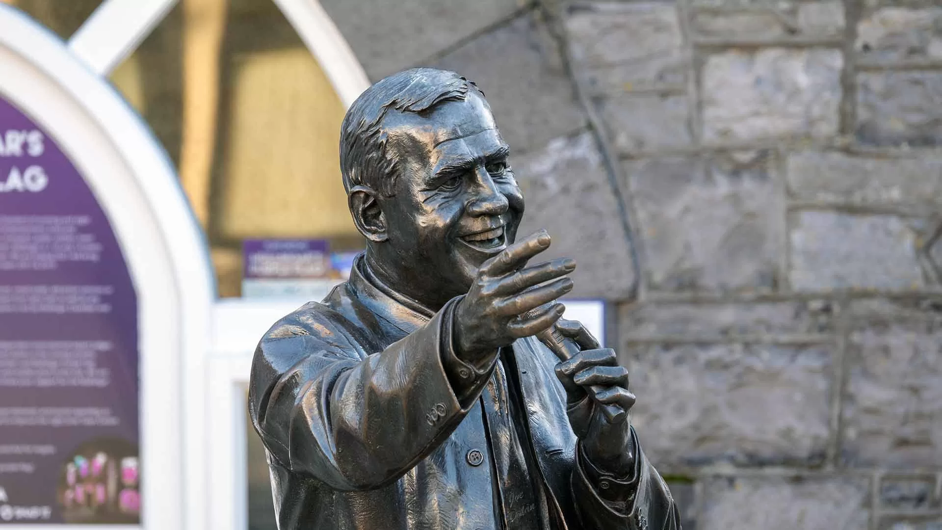
Joe Dolan (1939-2007) was an Irish pop singer who achieved fame in the 1960s and continued to be a popular performer in Ireland and beyond until his death in 2007. Born on October 16, 1939, in Mullingar, County Westmeath. So if you travel the Athlone Greenway please visit Joe, he’ll be glad to see you.

Waterford Greenway
Waterford Greenway
The Great Eastern Greenway
Tralee to Fenit Greenway

The Limerick Greenway
The Royal Canal Greenway
The Cork Harbour Greenway