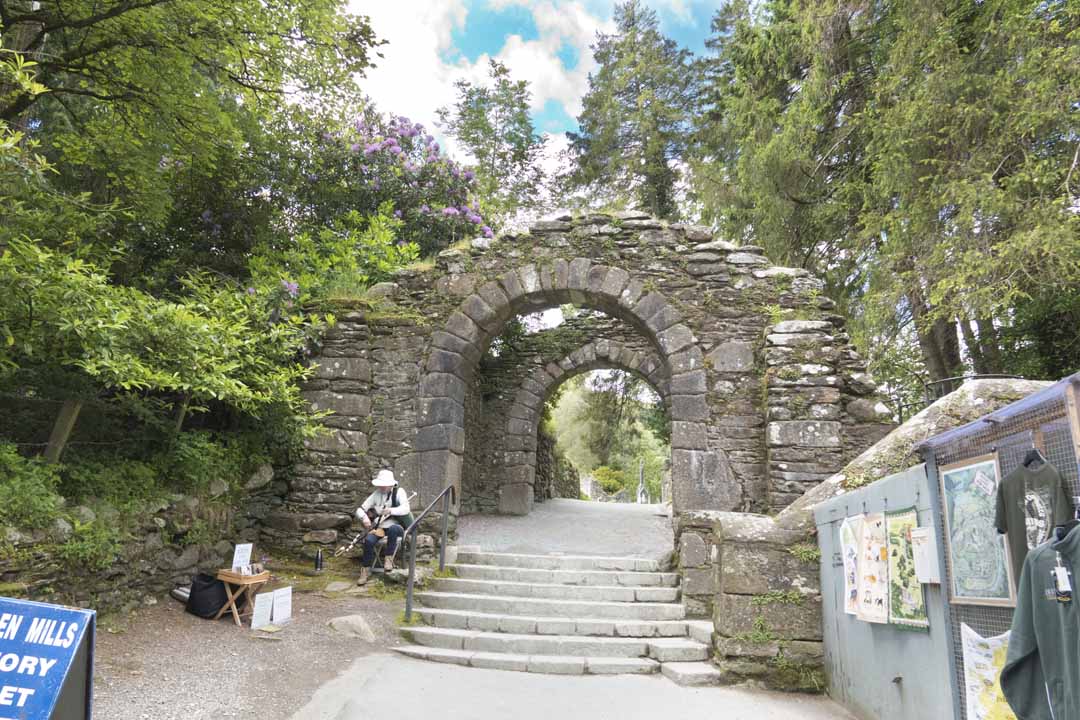
Local info
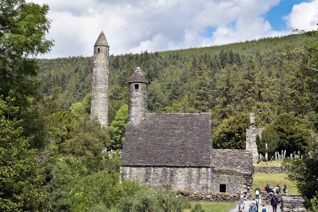
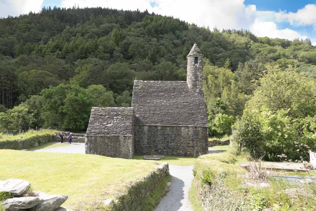
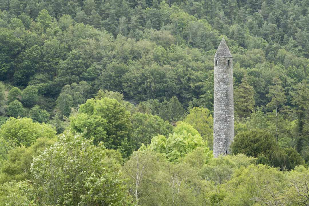
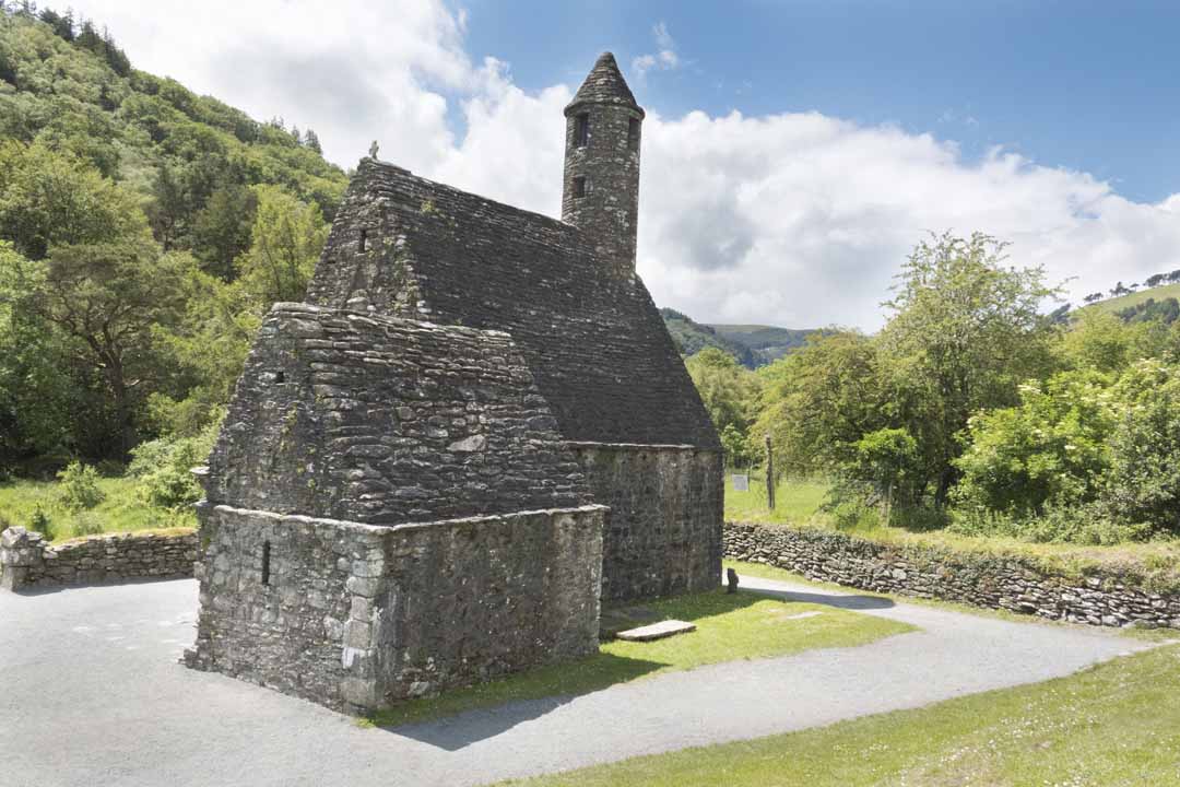
The Round Tower
The Round Tower
Round towers were the Campanilies or Bell Towers of Early Irish Monasteries and were used to summon the monks to prayer. This tower is 100 feet high and has six floors with wooden landings-now vanished. The top storey has four windows, and the upper storeys have one each. The door is almost 12 feet above the ground and was presumably reached by means of a movable ladder which those inside could pull up after them to prevent an enemy from entering the tower. The use of the hole just above ground level is unknown. This Round Tower was probably built sometime between 900 and 1200.
Round towers were the Campanilies or Bell Towers of Early Irish Monasteries and were used to summon the monks to prayer. This tower is 100 feet high and has six floors with wooden landings-now vanished. The top storey has four windows, and the upper storeys have one each. The door is almost 12 feet above the ground and was presumably reached by means of a movable ladder which those inside could pull up after them to prevent an enemy from entering the tower. The use of the hole just above ground level is unknown. This Round Tower was probably built sometime between 900 and 1200.
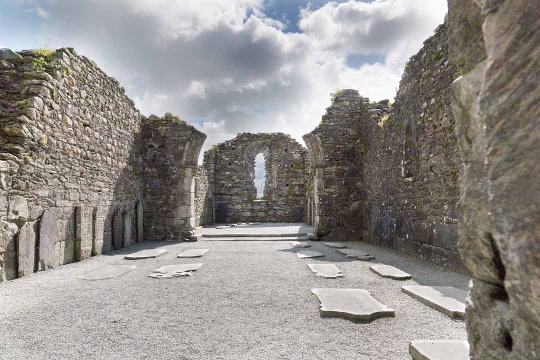
This is the largest church in Glendalough and was originally dedicated to SS Peter and Paul, but ceased to be a cathedral in 1214. The earliest part of the church is the nave, with its projecting artae to support roof-trusses and its flat-headed west doorway with relieving arch. The large rectangular stones of the bottom courses maybe 10th century in date, and the upper stones 11th century. In the 12th century the chancel with its finely decorated, through ruined chancel-arch, was added together with the sacristy, and a new doorway was inserted in the north wall. in the chancel are a mediaeval and some Early Christian gravestones, one with a double inscription asking for prayer for Diarmuit and for Maccois. Nearby is the large monolithic St.Kevin’s Cross of uncertain date.
This is the largest church in Glendalough and was originally dedicated to SS Peter and Paul, but ceased to be a cathedral in 1214. The earliest part of the church is the nave, with its projecting artae to support roof-trusses and its flat-headed west doorway with relieving arch. The large rectangular stones of the bottom courses maybe 10th century in date, and the upper stones 11th century. In the 12th century the chancel with its finely decorated, through ruined chancel-arch, was added together with the sacristy, and a new doorway was inserted in the north wall. in the chancel are a mediaeval and some Early Christian gravestones, one with a double inscription asking for prayer for Diarmuit and for Maccois. Nearby is the large monolithic St.Kevin’s Cross of uncertain date.
The Cathedral
The Cathedral
The “Priest’s house”
The “Priest’s house”
The ‘Priest’s House’ is a miniature 12th-century building, perhaps an oratory or shrine. Over the door is a fragmentary lintel with the representation of an ecclesiastic or monarch flanked by two abbots, one with a crozier and the other with a bell. At the east end is a unique alcove with a Romanesque arch.
The ‘Priest’s House’ is a miniature 12th-century building, perhaps an oratory or shrine. Over the door is a fragmentary lintel with the representation of an ecclesiastic or monarch flanked by two abbots, one with a crozier and the other with a bell. At the east end is a unique alcove with a Romanesque arch.
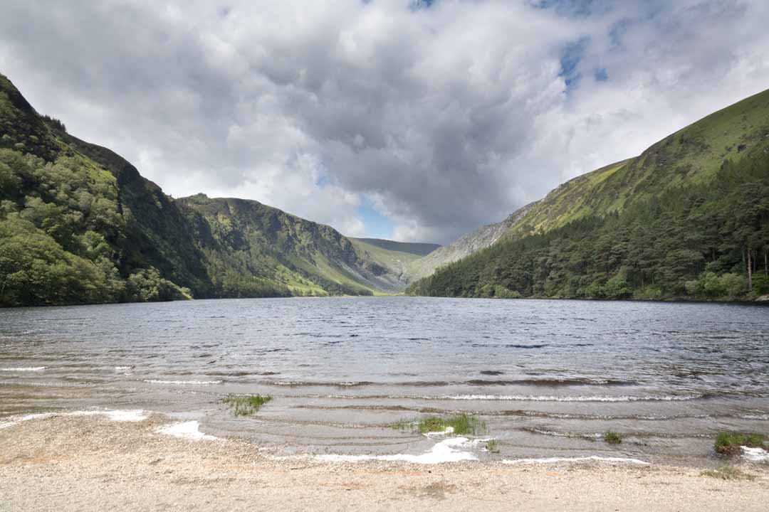
The name ‘Glendalough” means ‘valley of the two lakes’. These lakes were formed by glaciers moving down the valley. They are deep lakes: the larger one, at the head of the valley, has an average depth of 18 metres and reaches 30 metres at its deepest point.
The name ‘Glendalough” means ‘valley of the two lakes’. These lakes were formed by glaciers moving down the valley. They are deep lakes: the larger one, at the head of the valley, has an average depth of 18 metres and reaches 30 metres at its deepest point.
Small brown trout live in these waters. They are also frequented by Goosander, a fish-eating duck, and by Greylag Geese.
Small brown trout live in these waters. They are also frequented by Goosander, a fish-eating duck, and by Greylag Geese.
In the higher reaches of the mountains, there are ‘Corrie’ lakes. Such lakes were hollowed out during the Ice Age. Kelly’s Lake and Lough Ouler are examples of corrie lakes.
In the higher reaches of the mountains, there are ‘Corrie’ lakes. Such lakes were hollowed out during the Ice Age. Kelly’s Lake and Lough Ouler are examples of corrie lakes.
Miner’s Road Walk
Miner’s Road Walk
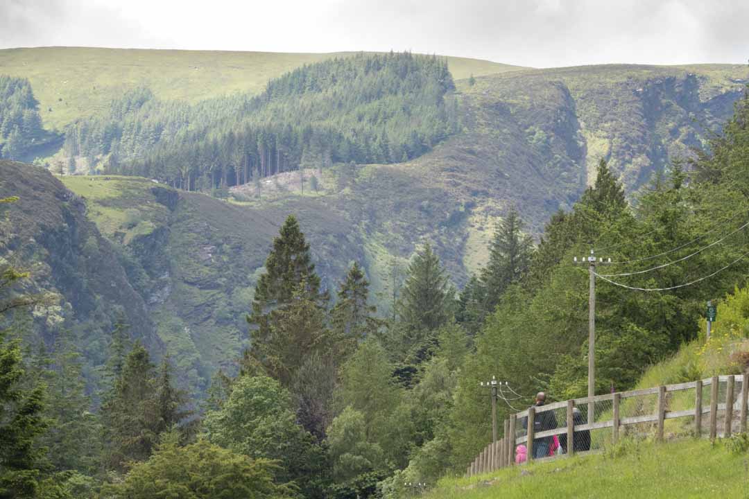
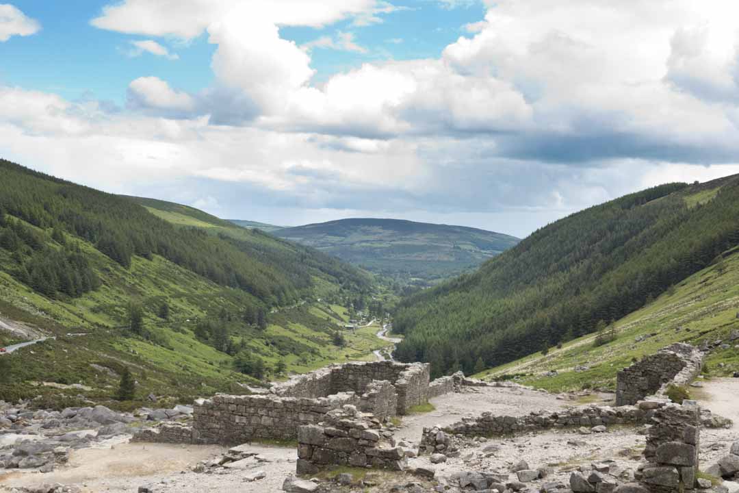
This walk skirts one of the upper Lake. The trail passes through Scot’s Pine woodland before reaching the ruined Miners’ Village. Halfway along the trail, the cave is known as St. Kevin’s Bed can be seen across the lake. Feral goats are common on this walk. peregrine falcons may on occasion be seen nigh in the sky soaring and calling to each other ( a high-pitched cry).
This walk skirts one of the upper Lake. The trail passes through Scot’s Pine woodland before reaching the ruined Miners’ Village. Halfway along the trail, the cave is known as St. Kevin’s Bed can be seen across the lake. Feral goats are common on this walk. peregrine falcons may on occasion be seen nigh in the sky soaring and calling to each other ( a high-pitched cry).
Grade: Easy
Grade: Easy
Distance: 5 km
Distance: 5 km
Time: 1 hour 15 minutes
Time: 1 hour 15 minutes
Metres Climb: 90 m
Metres Climb: 90 m
Woodland Road
Woodland Road
This is a pleasant walk through one of the more secretive areas of Glendalough. It weaves through mixed woodlands into neighbouring Glendasan Valley. The trail follows the Glendasan river back towards Glendalough where it then joins up with the boardwalk which runs through the Lower Lake wetlands.
This is a pleasant walk through one of the more secretive areas of Glendalough. It weaves through mixed woodlands into neighbouring Glendasan Valley. The trail follows the Glendasan river back towards Glendalough where it then joins up with the boardwalk which runs through the Lower Lake wetlands.
Grade: Ramble
Distance: 4 km
Time: 1 hour 15 minutes
Metres Climb: 90 m
Grade: Ramble
Distance: 4 km
Time: 1 hour 15 minutes
Metres Climb: 90 m
Green Road Walk
Green Road Walk
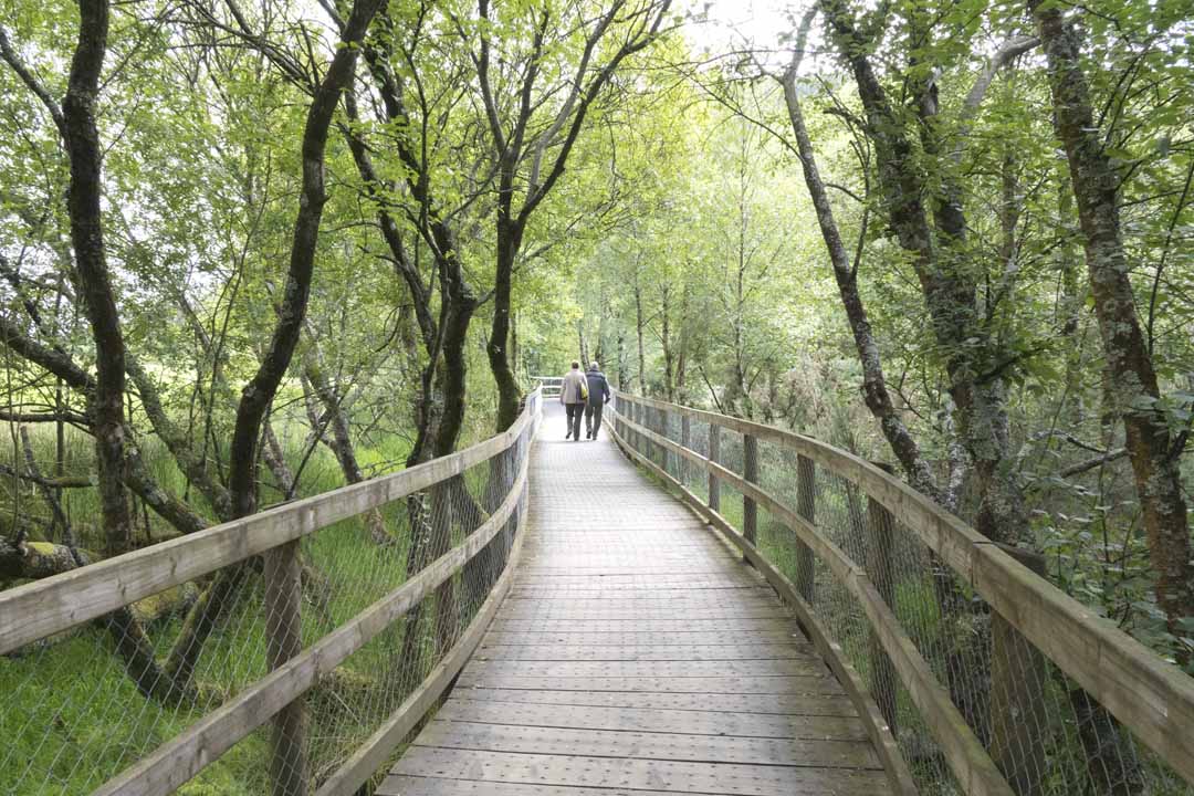
The Green Road is an easy stroll on mostly flat ground. This walk passes through the Glendalough oak woodlands before dropping down onto the lower Lake wetland edge. Views up the valley from the boardwalk here are spectacular. Lizards and dragonflies are often seen sunning themselves on the wooden trackway. The wetlands are a valuable breeding place for frogs.
The Green Road is an easy stroll on mostly flat ground. This walk passes through the Glendalough oak woodlands before dropping down onto the lower Lake wetland edge. Views up the valley from the boardwalk here are spectacular. Lizards and dragonflies are often seen sunning themselves on the wooden trackway. The wetlands are a valuable breeding place for frogs.
Grade: Easy
Distance: 3 km
Time 50 minutes
Metres Climb: 20 m
Grade: Easy
Distance: 3 km
Time 50 minutes
Metres Climb: 20 m
Poulanass
Poulanass
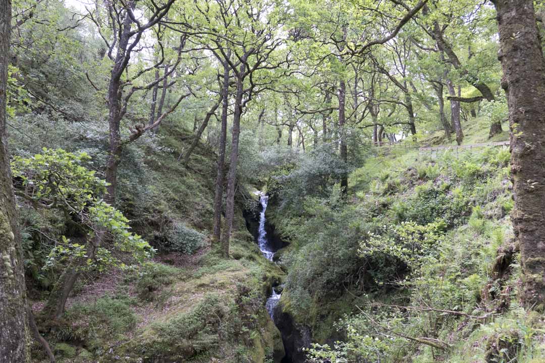
This trail begins with a short but steep climb up by Poulanass Waterfall and plunge pool. (The name is taken from the Irish ‘Poll an Eas’ which means ‘hole of the waterfall’.) The trail crosses above the waterfall to drop down through mixed woodlands to the valley floor. Listen out for woodland birds, in particular jays, which can be quiet noisy.
This trail begins with a short but steep climb up by Poulanass Waterfall and plunge pool. (The name is taken from the Irish ‘Poll an Eas’ which means ‘hole of the waterfall’.) The trail crosses above the waterfall to drop down through mixed woodlands to the valley floor. Listen out for woodland birds, in particular jays, which can be quiet noisy.
Grade: Moderate
Distance: 1.6 km
Time: 40 minutes
Metres Climb: 100 m
Grade: Moderate
Distance: 1.6 km
Time: 40 minutes
Metres Climb: 100 m
Spinc and the Wicklow Way
Spinc and the Wicklow Way
This walk follows the same route as the other Spinc trails up onto the boardwalk. It stays on this boardwalk for 1.7 kilometres before turning off in the direction of Lugduff Mountain. This section of the trail is a good place to spot deer and birds such as Raven, Merlin and Kestrel. Finally, the trail links up with the Wicklow Way track to lead you back to the Information Office.
This walk follows the same route as the other Spinc trails up onto the boardwalk. It stays on this boardwalk for 1.7 kilometres before turning off in the direction of Lugduff Mountain. This section of the trail is a good place to spot deer and birds such as Raven, Merlin and Kestrel. Finally, the trail links up with the Wicklow Way track to lead you back to the Information Office.
Grade: Hill Walk
Distance: 11 km
Time: 2 hours
Grade: Hill Walk
Distance: 11 km
Time: 2 hours
Spinc (Short Route)
Spinc (Short Route)
Although this walk is short in comparison to the other Spinc routes, it still leads you into mountains terrain where navigation experience is necessary. The walk follows the poulanass Waterfall before entering the Lugduff Valley. From there, a steep climb up steps brings you onto the boardwalk. This trail continues for 1.2 kilometres along the boardwalk which hugs the cliff of the Spinc, before cutting down through the forest to lead back towards the Information Office.
Although this walk is short in comparison to the other Spinc routes, it still leads you into mountains terrain where navigation experience is necessary. The walk follows the poulanass Waterfall before entering the Lugduff Valley. From there, a steep climb up steps brings you onto the boardwalk. This trail continues for 1.2 kilometres along the boardwalk which hugs the cliff of the Spinc, before cutting down through the forest to lead back towards the Information Office.
Grade: Hill Walk
Distance: 5 km
Time: 2 hours
Grade: Hill Walk
Distance: 5 km
Time: 2 hours